
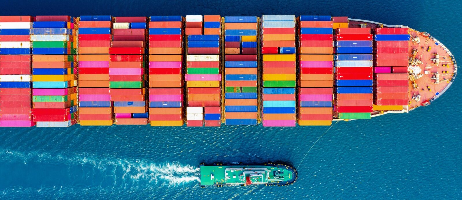
Vessel alongside is a maritime term referring to a situation where one or more vessels are positioned parallel to another. This practice can have various logistical and safety implications. Detecting such scenarios is crucial in port environments, areas with heavy maritime traffic, and for surveillance in strategic regions. In this context, medium, high, and very high-resolution satellite imagery coupled with AI algorithms provides a suitable solution for monitoring and detecting vessels alongside.
Input Images
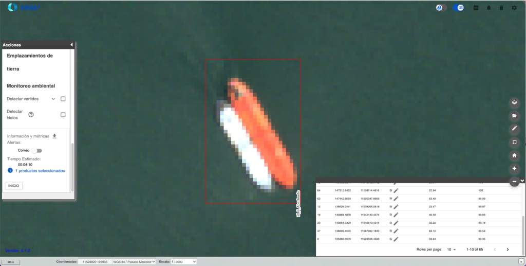
For the detection of vessels alongside, we employ optical satellite images with medium/low resolution (6-30 m/px), high resolution (1-6 m/px) and very high resolution (0.3-1 m/px) which offer different levels of detail depending on the scale. While medium-resolution images allow for covering large areas, higher resolution images are necessary to accurately capture the proximity and potential contact between vessels.
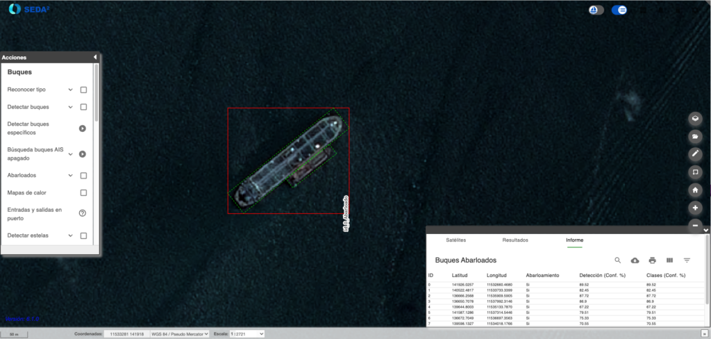
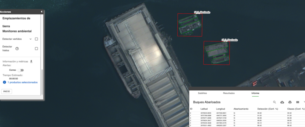
One of the main challenges is the overlap of objects in congested ports and the variability of environmental conditions, such as lighting or satellite perspective, which can hinder the accurate detection of vessels. To address these challenges, SEDA has used a model based on convolutional neural networks (CNNs), trained with images from different sources to improve the system's capability in complex scenarios. These CNNs must overcome difficulties such as the visual similarity between ships and their close or overlapping position in ports. Additionally, the differences in spatial resolutions require preprocessing and adjustments in the model in each case, as each type of image provides a different level of detail that influences the accuracy of the analysis.
Model Output
The analysis results are visualized in the GIS system integrated into SEDA. This system allows for the creation of interactive maps and the generation of detailed reports that include precise geospatial information about the location and proximity of the detected vessels.
Reports with the results are offered in various formats widely used in defense and surveillance, such as geojson, shapefiles, KML, NVG, Shapefile, or NATO formats like NSIF image and xml RECCEXREP and ISRSREP, allowing for integration into command and control systems or other analysis platforms.
Practical Applications
The detection of vessels alongside offers various practical applications. In port and maritime traffic surveillance, it allows for the identification of irregular or dangerous activities in areas with a high concentration of vessels. Additionally, it is key for the prevention of illicit activities, as real-time analysis can reveal signs of smuggling or human trafficking. It is also essential for monitoring the security of critical infrastructure, detecting unauthorized vessels alongside strategic facilities or high-value vessels. With SEDA, both authorities and maritime surveillance companies can obtain a clear and detailed view of what is happening at sea, thus improving the management and security of the areas under their control.