
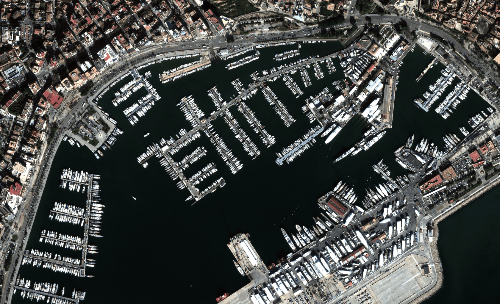
The detection of vessels entering and exiting ports using Remote Sensing is becoming an increasingly sophisticated and essential tool in modern maritime management. This technology leverages the capability of remote sensors to capture images and data from the Earth's surface via satellites or aircraft. By applying image processing techniques and artificial intelligence algorithms to these data, it is possible to identify and track vessel movements in port areas with unprecedented accuracy and efficiency.
Remote Sensing offers a unique, large-scale perspective on maritime activities. By analyzing satellite or aerial images, detection systems can identify movement patterns on the water that correspond to vessels. Furthermore, using object recognition techniques, it is possible to classify vessels by their type and size.
Model Input
Accurate and reliable detection of vessels entering and exiting ports is a crucial task in modern maritime management. For this to be done effectively, the quality of the images used is fundamental. In this context, high-resolution optical images, with a spatial resolution better than 0.5 meters per pixel, have become an essential tool.
The resolution of an image refers to the level of detail it can distinguish. In the case of satellite or aerial images, a higher resolution means that each pixel represents a smaller area of the Earth's surface. By employing images with a resolution finer than 0.5 m/px, it is possible to distinguish much finer features of objects like vessels. This allows for more accurate identification of characteristics such as size, shape, type of vessel, and, in some cases, even details of cargo or activities onboard.
With a low-resolution image, a small vessel might be mistaken for background noise or part of a larger vessel. However, with a high-resolution image, the smaller vessel will stand out clearly, allowing for its identification and tracking.
In addition to identification, high resolution is crucial for obtaining specific features of each vessel, enabling the differentiation between types through automatic classification using AI models.
AI Model Output
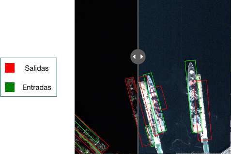
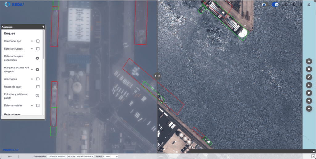
At SEDA, taking advantage of the power of the vessel detection model, this new functionality has also been integrated to provide detection of vessel entries and/or exits at ports chosen by the operating user. For this, a time range for the comparison and a maximum allowable cloud cover percentage are required. With these inputs, SEDA searches for images that fit the search parameters and performs analysis using AI models, offering a visual output that compares the analyzed images and highlights vessels that have exited or entered the port with color markers.
Applications
Vessel detection through remote sensing has a wide range of applications, including:
- Maritime Security: Identification of suspicious activities such as smuggling or illegal fishing.
- Port Planning: Design and management of port infrastructure.
The benefits of this technology are numerous:
- Broad Coverage: Enables continuous monitoring of large marine areas.
- Remote Operation: Detection systems can operate autonomously, reducing the need for on-site personnel.
- Historical Data Analysis: Collected data can be used to analyze long-term trends and assess the impact of various factors on maritime traffic.