USE CASES

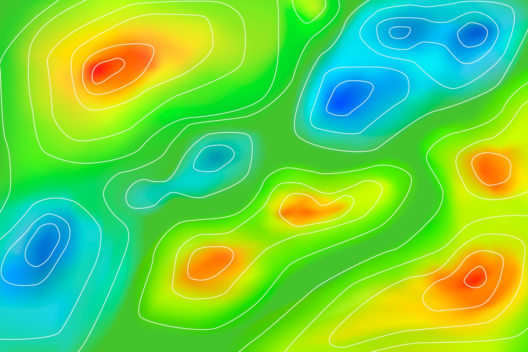
Heat Map Representation
Read more: Representación de Mapas de CalorVisualizing maritime traffic through heat maps provides a clear and dynamic perspective on naval activity in strategic areas. This analysis begins with a phase of vessel detection or classification using satellite imagery, identifying types of ships, routes, and movement patterns.Once identified, heat maps highlight...

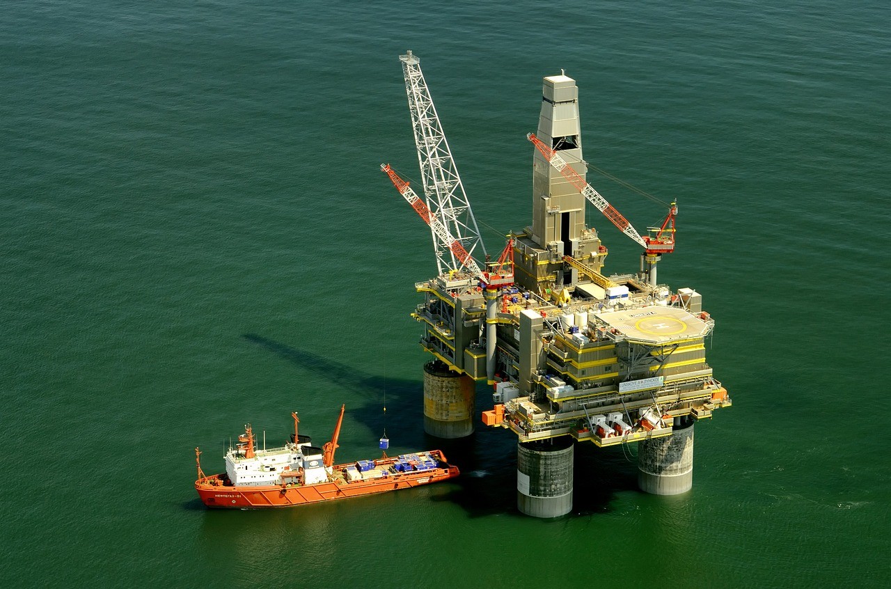
Large structures detection
Read more: Detección de grandes estructurasThe detection and classification of large structures consists of detecting and identifying the type of structure, differentiating between offshore platforms and windmills. The automation of this task is important for both maritime and environmental safety. This involves considerable reduction of time and costs necessary for the analysis and...

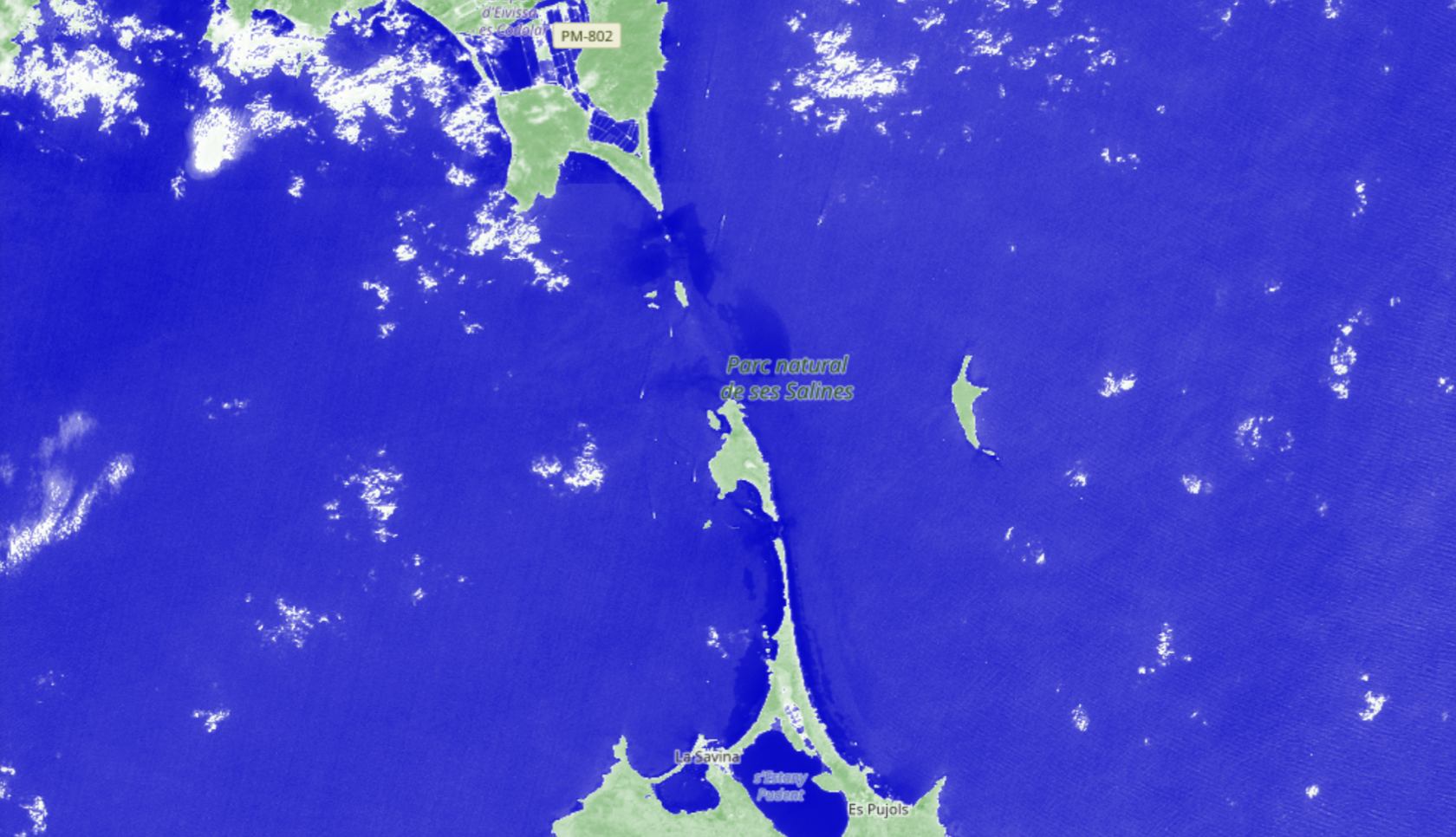
Shoreline change detection
Read more: Detección de cambios en línea de costaCoastal change detection through comparative analysis of medium-resolution satellite images (approximately 10 meters per pixel) is an advanced methodology for monitoring alterations in coastal areas over time. This process involves comparing images taken at different points in time to identify variations in the coastline’s position, enabling precise analysis of changes due to erosion, sedimentation, human construction, or climate...

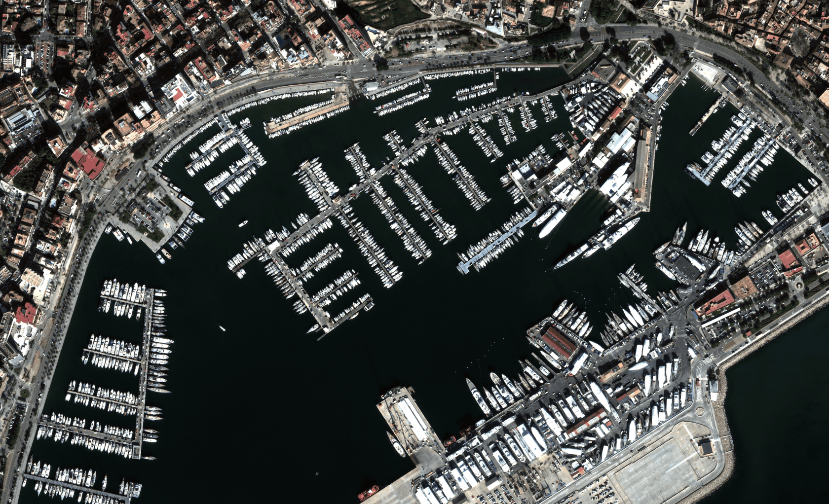
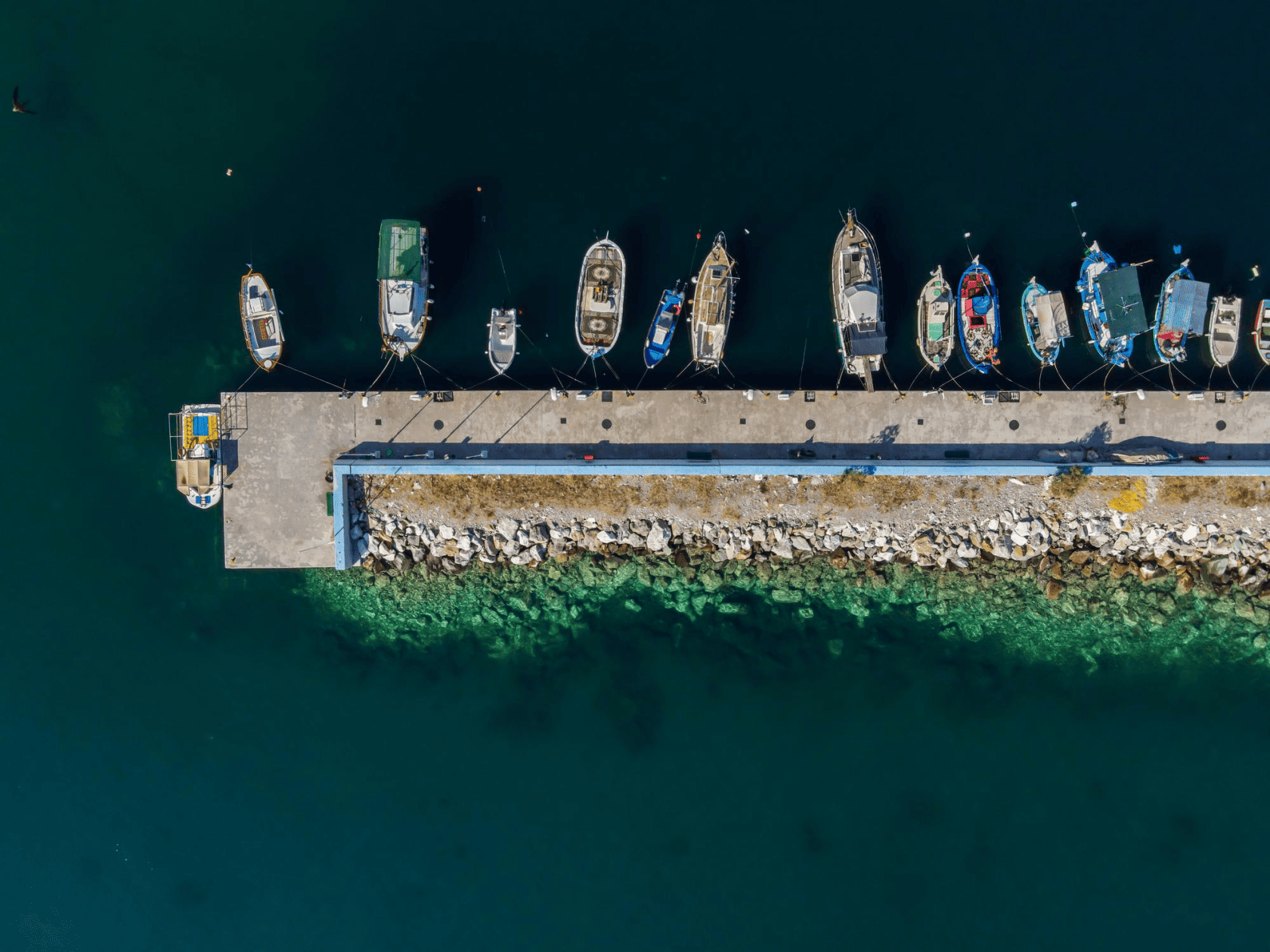
Port departure detection
Read more: Detección de salidas de puertoThe detection of vessels entering and exiting ports using Remote Sensing is becoming an increasingly sophisticated and essential tool in modern maritime management. This technology leverages the capability of remote sensors to capture images and data from the Earth's surface via satellites or aircraft. By applying image processing techniques and artificial intelligence...

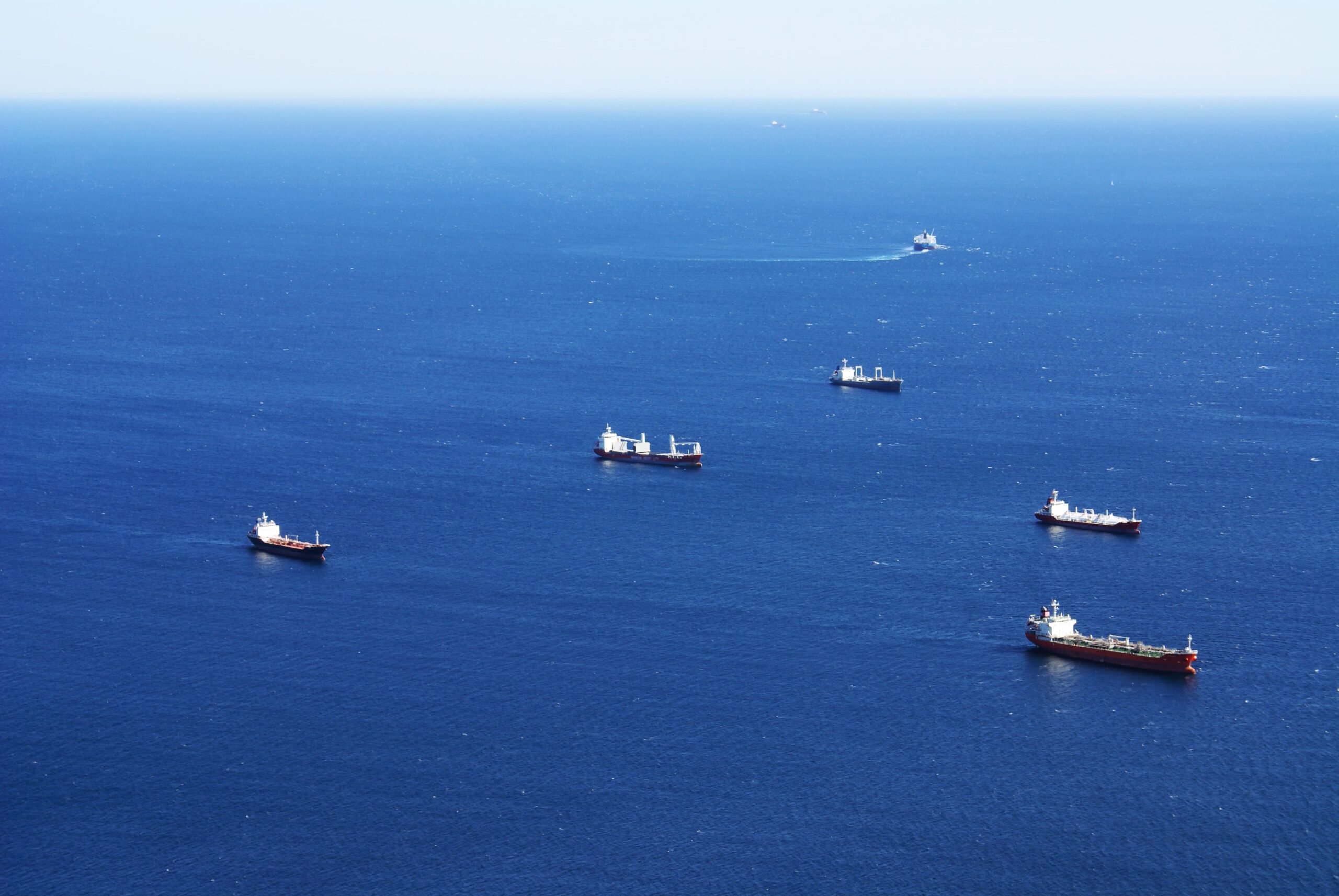
Vessel detection with AIS off
Read more: Detección de buques con AIS apagadoThe concept of a dark vessel refers to ships that intentionally turn off their (Automatic Identification System o AIS) or manipulate their data to avoid detection and monitoring. These practices are illegal, as AIS is a crucial communication system for maritime safety, collision prevention, and monitoring activities...

Vessel detection with few reference images
Read more: Detección de buques con pocas imágenes de referenciaVessel detection and classification in satellite imagery is a fundamental task in multiple applications, from maritime surveillance to maritime traffic management. This technology makes it possible to monitor large areas of water efficiently and obtain valuable information about maritime activity. Vessel detection consists of identifying the presence of a ship in a satellite image. Traditionally, image processing techniques...

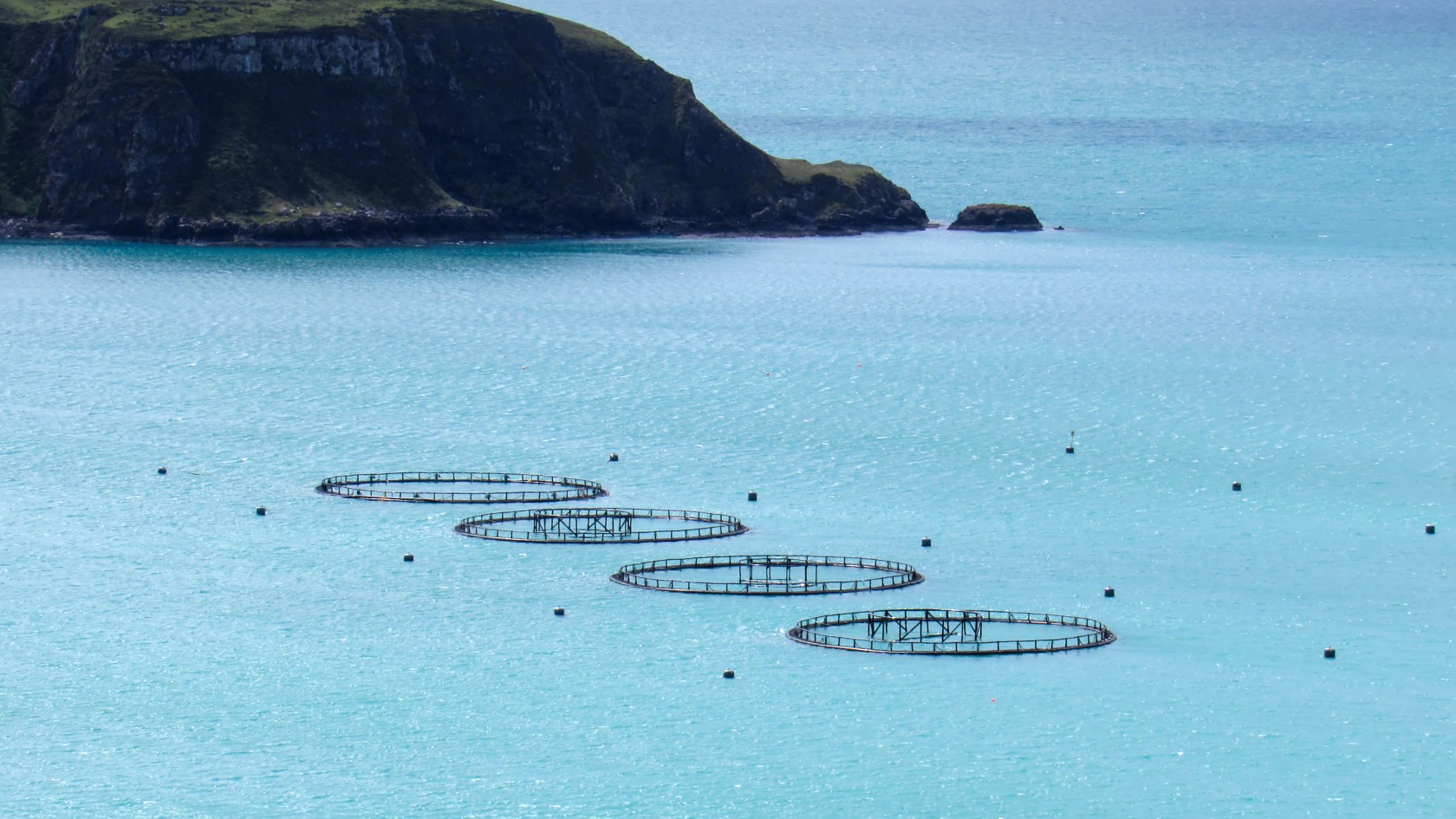
Marine farm detection
Read more: Detección Granjas MarinasMonitoring and managing marine farms is crucial in the aquaculture industry and in the conservation of coastal ecosystems. Satellite imagery allows for continuous and detailed observation of these areas, which is essential to optimize production and minimize environmental impact. In this field, convolutional neural networks...

Wake detection
Read more: Detección de estelasShip wake detection particularly interesting because of the challenges of identifying vessels that turn off their identification systems. Traditionally, optical and radar imaging have been used to locate ships, but these methods encounter difficulties when dealing with small ships or structures that can be confused with natural objects such as...

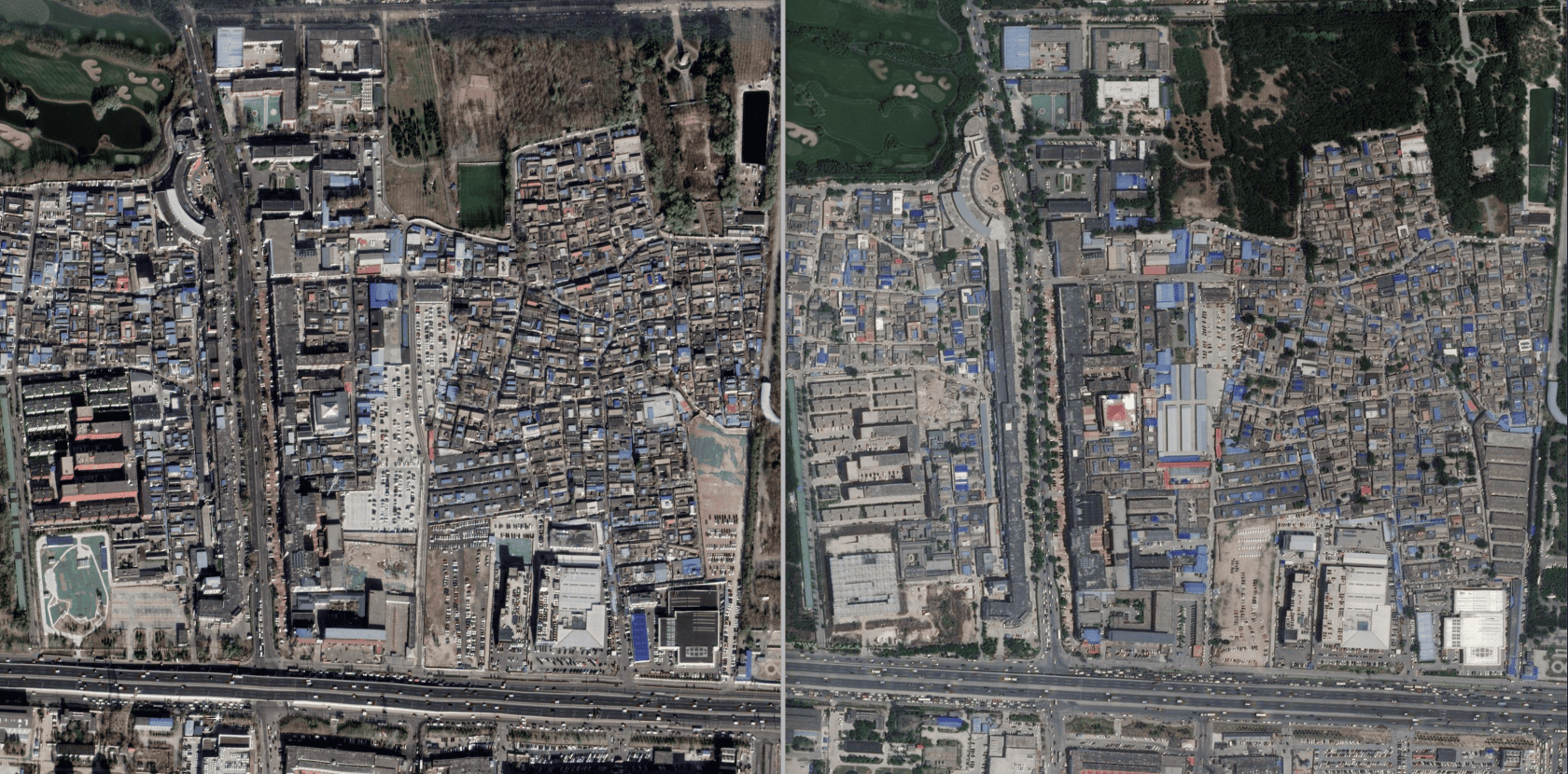
Cartographic change detection
Read more: Detección cambios CartográficosCartographic change detection is used to identify and monitor transformations in the terrain, such as new constructions or modifications in infrastructure. This use case relies on high-resolution (HR) and very high-resolution (VHR) satellite images that allow for detailed observation of urban changes between two images. This use case implements a model that combines elements of...
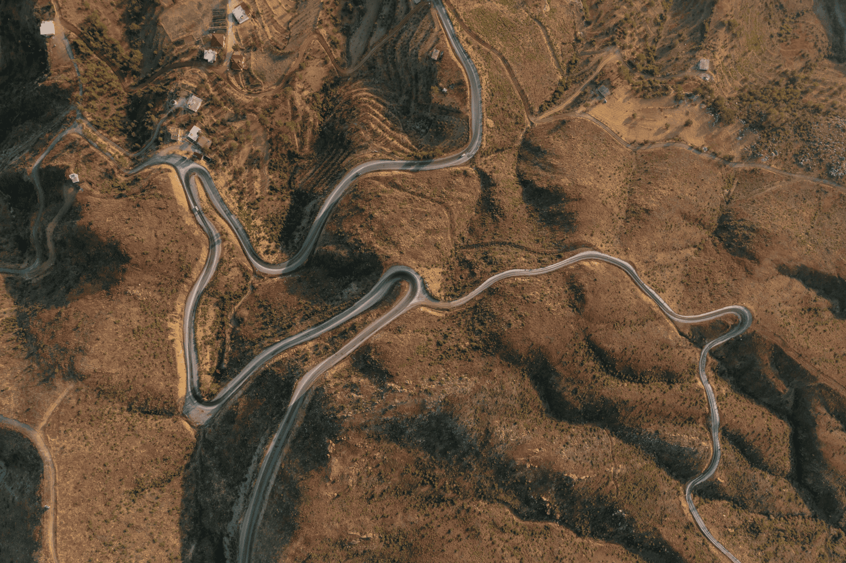
Highways and roads segmentation
Read more: Segmentación de Carreteras y caminosShip segmentation of highways and roads in satellite images is a fundamental process for applications in the field of geospatial intelligence. By using high-resolution (HR) and very high-resolution (VHR) images with a precision of 1.5 m/pixel or less, the system allows for the precise detection, delineation, and mapping of road networks...